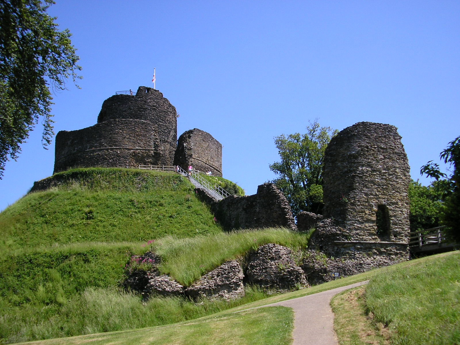
Launceston Castle
Launceston Castle, is set on a large natural mound and dominates the surrounding landscape and offers breathtaking views of the historic town and countryside.
Launceston to Altarnun
Below the ruins of a 1000 year old castle lies the ancient town of Launceston which up until 1835 was Cornwall’s capital. It derives its name from the Abbey of St Stephen’s (pronounced ‘Lanson’) and St Thomas’s Church which sits close to the priory ruins and the old railway station aptly defining the first section of this walk. At the end of the churchyard is a small lane which passes over the narrow gauge railway and continues along the River Kensey Valley to the hamlet of Newmills (2.5 miles). As the road retreats from Launceston it allows a glimpse of rustic Cornwall, although our journey along the single road ends just before the farm at Newmills; during the summer many walkers stop here (at present the railway terminus), as it is open to the public with café/toilets and allows a close up view of the narrow gauge train system.
The pilgrimage trail turns left before reaching the farm and follows a steep climb towards Tregadillett; this route is frequently used by local train enthusiasts who like to extend their travels to the Eliot Arms, a popular pub on this section of the walk.
Tregadillett is the largest settlement in the parish of St Thomas (‘The Apostle Rural’) with a population of over 800 people; the pub was a coaching inn during the 17th century; later becoming a blacksmiths and then restored in 1840 as a pub called The Square and Compass which is still retained as a title.
Leaving the inn, the pavement veers right towards the end of the village and A30 junction. Lying east of the parish is South Petherwin which is the next destination along the way. Cross carefully to join the road to Kennard’s House and South Petherwin; the diminutive country route offers a peaceful alternative the hazardous A30 though care must be taken for the remainder of this section to Five Lanes. At South Petherwin join the busier B3254 (right turn) and head south towards Hollyvaag Farm and at Congon Shop turn right on to the B3257, (you may find a few alternatives routes along farm tracks to Lewannick). The next 2 miles form a narrow road flanked by hedges as the journey takes in Kelly’s House and the rural surroundings of Lewannick and Plusha.
There is a village store/post office at Lewannick and the Archer Arms stands across the road from St Martin’s Church. This old village is known for the many variations of its name and there are properties here that date back to the 14th century and the nearby Trelaske Manor features in the book of Doomsday. The church made up of mixed interior has some Roman features and close by is the Holy Blaunder’s Well said to contain water that is soothing to the eye.
Leaving the village, turn right at the pub and walk downhill to the old garage; bear right and walk to Plusha Cross. At the road junction cross the Callington Road (B3257) and rejoins the country lane on the left for a winding excursion along farm tracks to Five Lanes.
Nearing the end of this section the dual carriageway above begins to close in bringing with it the constant drone of traffic.
Passing under the A30 at Five Lanes will immediately expose you to the idyllic Kings Head Hotel and inn, a charming location with excellent facilities for a weary traveller! Five Lanes is part of Altarnun and from here the road descends into Altarnun and the iconic 15th century Church of St Nonna, also known as the ‘Cathedral of the Moor’.